Machame Route
Distance: ~39 miles in 7 days.
Total Elevation Gain: 16,044 ft
Day 1:
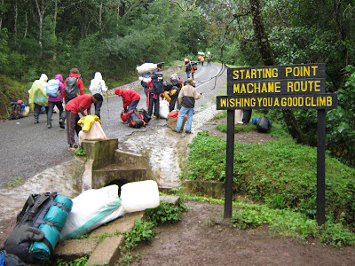 |
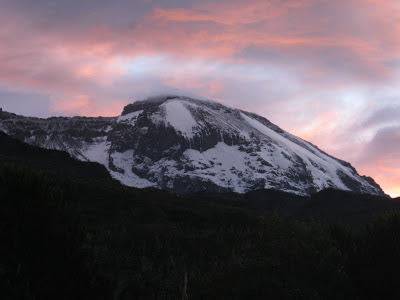
| The start of the Machame Route |
Start: Machame Gate 6,000 ft
End: Machame Hut 9,900 ft
Elevation gain: 3,900 ft.
Time: 6 hours on average
Distance: ~ 6 miles
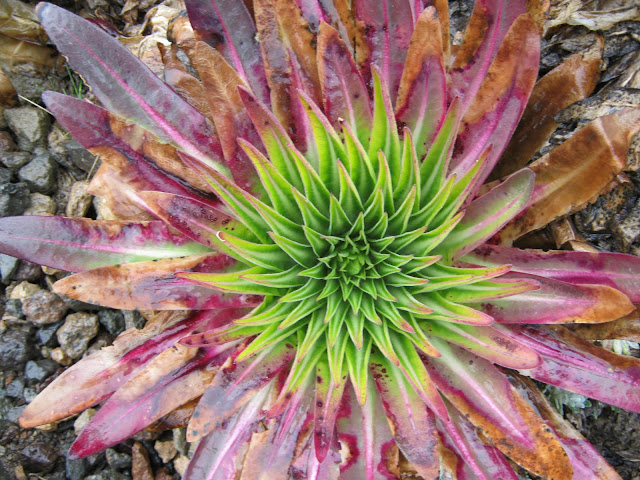
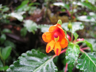 |
| One of many beautiful flowers seen on the climb |
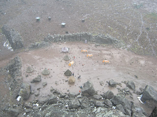
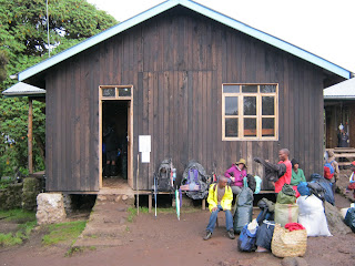 |
| Machame Hut |
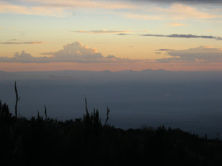 |
| Sunset from Machame Cam |
While driving up to the Machame Gate, it was pouring. The rain abated for a short time after we arrived at the gate. Ten or twenty other groups of climbers were also at the gate, signing the mandatory register and readying themselves for the upcoming climb. Our group was comprised of just me and my mother. Despite our small group size, we still had two guides, a cook and six porters. Our biggest anxiety was not the climb ahead but was instead the fact that our bags and all our gear (which had been lost by the airline) had still not arrived. We were assured that the bags would be found and that a porter would bring them up to the first camp. We had come all this way and were determined to press on and hope the bags would arrive. The first
mile or so is on a wide, dirt service road. After that, a narrower but
still well maintained trained continued up through the jungle. The
flowers and plants along the route were amazing but there was almost no
animal life that could be seen. A brief glimpse of a monkey high above
was pretty much all a saw all day. While the trail was often rather
steep, the hiking never felt particularly difficult. I was particular
impressed with the porters who shouldered mammoth loads and yet still
move faster up the mountain that any of the climbers. About halfway up the trail to Macheme Camp, the sky darkened
again and the shrieking of monkeys rang through the forest. Moments
later, the sky opened up
and a torrential downpour came down. Apparently, the monkeys are no
more fond of this kind of weather than I am. I spend the next hour
getting drenched despite my rain gear and rolled into Machame Camp
feeling cold and wet. The first order of business was to find the
ranger hut and sign in. This would be a ritual that would have to be
repeated at all of our future stops. Our campsite was soon set up and
we were delighted to find that our bags had indeed showed up. We were
amazed by just how many people were in camp. It felt like a small
town. This was clearly not going to be any experience of solitude in
the wilderness. This was okay as we came to enjoy social atmosphere and
meeting folks from all over the world.
Day 2:
 |
| First view of the mountain |
Start: Machame Hut 9,900 ft
End: Shira Hut 12,500 ft
Elevation gain: 2,600 ft.
Distance: ~ 5 miles
 |
| Preparing to leave camp |
 |
| Shira Peak |
We were awakened on the second by the sounds of dozens, if not hundreds, of songbirds. It was unlike anything I'd ever heard. The morning gave us our first clear view of the mountain. Even though we were still far below, it really didn't seem all that far away. The camp was soon
humming with activity as climbers prepared for the days hike and ate
breakfast while the porters packed up the tents and loaded their
bundles. Shortly after 8am, we were on the trail heading up to Shira
Camp. The trail was still rather muddy from the previous day's rain and
was rather steep. As we cleared the forest, we were rewarded with some
beautiful views of the mountain and surround areas. To our left, we
could see the relatively modest summit of Shira Peak. To our right, we
could see the impressive slopes of Uhuru Peak rising above us. Behind
us, we had a spectacular view of the 14,977 foot summit of Mount Meru.
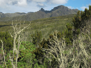
Soon we were climbing along the spine of a ridge and got our first
glimpses of the giant lobelia and senecio plants for which Kilimanjaro
is famous. At about 9:30-10am, the clouds began climb up the mountain
and with them came the rain once again. The last hour or so of the
climb was very cold and soggy. This stretch was also the most
challenging and scenic but I really didn't have much of a chance to
enjoy it in the rain. We soon crested a gentle ridge and began a short
descent into Shira Camp. Camp was very wet when we arrived so most of
the climbers waited on the nice porch of the camps ranger hut. The sky briefly
cleared and provided some sun with which to dry our packs and jackets.
When the sun disappeared behind the clouds, I signed the register and
headed down to the campsite which had been prepared for us. After a
very filling lunch, I climbed into my sleeping bag to warm up and ended
up sleeping for about three hours. Shira Camp has many interesting
caves and rock formations and I passed most of the time before dinner
exploring around the camp. The rain began to pick up again after dinner
so we retreated to the tent and spent the remainder of the evening
hunkered down. Before going to sleep, our guide, Babaluu, stop by to go
over the plan for the next day. He suggested that we try getting up
even earlier for the next day's climb in order to stay ahead of the
rain. He told us that Day 3 would be an important acclimatization day
as we would be climbing up above 15,000 feet before descending down to
around 13,000 feet to Barranco Camp. We feel asleep quite early as slept soundly for the next 9 hours.
 |
| Climbing the ridge to Shira Camp |
On a side note, I was very impressed with our porters today. One of our six porters slipped, fell and injured his ribs today and have to be taken down the mountain. Our remaining porters elected to shoulder the extra load rather than having a new porter sent up so that the injured porter would get his salary. Very moved.
 |
| A very wet Shira Camp |
|
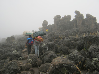
Day 3:
 |
| Sunrise at Shira Camp |
Start: Shira Hut 12,500 ft
End: Barranco Hut 12,900 ft
Elevation gain: 2,830ft
Distance: ~6 miles
 |
| Mount Meru from Shira Camp |
 |
| The climb above Shira Camp |
 |
| Looking down from the Lava Tower |
 |
| Barranco Camp |
|
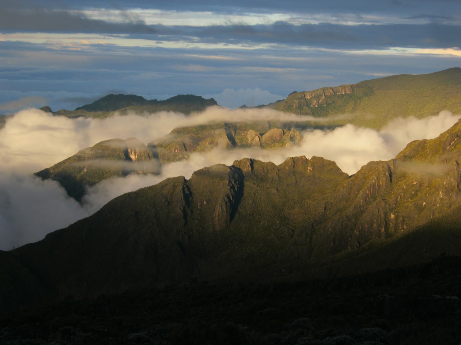
The morning of Day 3 was rather cloudy but the views that we did have of Shira Peak and Mount Meru were unbelievably beautiful. As planned, we got going earlier than the previous day and hoped that today would be drier than the previous days. That hope was short lived as the rain rolled in again, only even earlier than before. The terrain through which we climbed was quite different from what we'd experienced so far. It was rocky and desolate and had a distinctly volcanic feel. About an hour and a half after leaving Shira Camp, we join the Shira Route and the trail turned sharply right, our next destination would be the Lava Tower at about 15,100 feet. It took about 45 minutes
from the right turn to reach the Lava Tower, and when we did, the rain
turned to sleet. I waited at the Lava Tower for my mother and our
guides and decided that I would pass the time by climbing to the top of
the Lava Tower. Though most sides of the tower are a formidable climb, I
was able to find a fairly easy route up through the rocks. Had the
weather be clear, I would have been greeted with excellent views of the
mountain and the area below, but I really couldn't see much more than
the tents at the base of the tower. After descending, I found the rest
of my group and enjoyed a quick lunch with hot soup. From here, we
descend to Barranco Camp and this would prove to be the toughest part of
our entire climb. While we had become accustomed to the rain, we had
always been climbing and this had always kept us warm. Now we faced an
hour and a half descent in the rain and had no way of keeping up the
body temperature. The valley that we descended was incredible but it
was difficult to enjoy while being cold and wet. The senecios and giant
lobelia were everywhere and there were many streams and waterfalls coming down through the rocks. By the time we reached
Barranco Camp, I was just about as cold as I've ever been. Dozens of
climbers huddled up on the small porch of the Barranco Camp ranger hut
and shivered as we waiting for our campsites and tents to be ready. The
rangers to pity on us and let us get out of the rain and warm inside
the huts bunk rooms. After about 30 minutes our guide came to get us and
brought us to our tent. We were very grateful that hot tea, dry
clothes and a warm sleeping bag were waiting for us. The rain
had been so relentless for the past three days that some folks in our
group decided to give up the s ummit and head down rather than endure
additional days in the cold rain. We were also very cold and wet and sick of the rain but fully intended to stick it out.
 |
| Giant Lobelia |
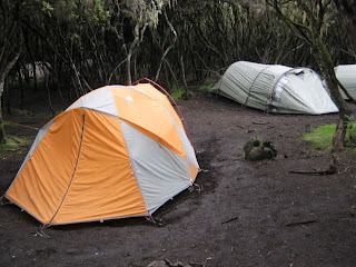
Day 4 :
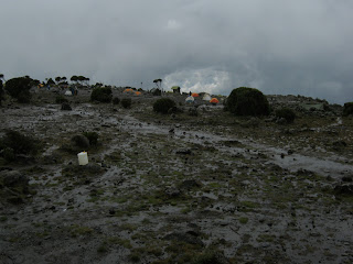
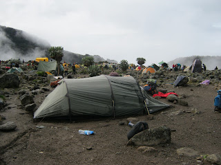
 |
| Karanga Camp |
Start: Barranco Hut 12,900 ft
End: Karanga Valley 13,300 ft
Elevation gain: 400ft
Distance: ~ 3 miles
We were not encouraged when we poked our head out of our tent and found that visibility was less than 50 yards. We started the hike to Karanga Camp at 7:30am in order to get ahead if the crowds going up the Barranco Wall. The Barranco Wall begins right at the edge if camp and steeply rises 1,500 up. It is not particularly difficult but will test someone with acrophobia. Visibility was minimal the entire way up. After reaching the top if the ridge in about 45 minutes, I waited another 20 minutes for one of the guides to arrive. As I waited, the fog turned to rain and I realized that I would once again show up to our next camp cold and wet. The remaining trail to Karanga Camp was a continuous series of ups and downs as we traversed from one valley to the next. After one last steep climb, we finally arrived at Karanga Camp. I once again arrived ahead of the tents and ended up hiding under the lip of a large boulder with 4 or 5 porters who were also trying to get out of the rain. Fortunately, the rain began to abate around noon. There wasn't a whole lot to see and do around the camp but it was nice to be able to walk around without getting rained upon. By sunset, the clouds had mostly receded down the mountain. The sunset was quite lovely and offered hope of better weather ahead. Give then the next day would be our easiest hike, we would be able to sleep a little later. We were grateful.
Day 5:
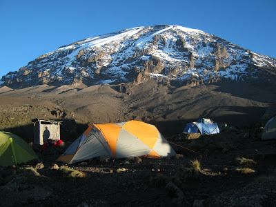 |
| Our Tent at Karanga Camp with Uhuru Peak in background |
Start: Karanga Valley 13,300 ft
End: Barafu Camp 15,331 ft
Elevation gain: 2,300 ft.
Time: 5 hours
Distance: ~3 miles
 |
| View across high desert to Barafu Camp |
The hike from Karanga Camp to Barafu Camp was steady but gentle incline The trail enters a high desert plateau that is littered with volcanic boulders. The hike only takes between 90 minutes and two hours to complete. There is a short, steep climb up to the flat but somewhat narrow ride upon which Barafu Camp is perched. Because of this, the campsites are strung out over a space of almost 500 yards. At just about the point where the ridge steepens was the Barafu ranger hut. We camped about 100 yards below the hut near some toilets precariously perched on the edge of a cliff. For the most part, the weather held today. We had a few short showers pass over us but nothing more. When the sky was clear, we got our first views of the third of the three peaks making up Mount Kilimanjaro, Mowenzi Peak, a steep and dramatic tower to the south. I was very pleased that I seemed to be having little trouble with the altitude, even here at over 15,000 feet. I'd been a little worried the last couple days beacuse of a growing headache at the back of my head. However, it turned out to be just pain from a knot in my neck from sleeping in a tent for several days. After rubbing it out, I felt golden. Now that we had reached our final camp before the summit, my excitement was starting to build. The plan was that we would go to sleep right after dinner and awaken around midnight. I was hoping that I wouldn't be too excited to sleep and I knew I would need my strength the next day. After dinner, the porters brought us hot water to fill our bottles for the climb to the summit. I was very grateful to have brought a 40oz Hydro Flask insulated bottle as the hot tea during the hikes had been a very nice treat. Out guides stopped by and did a final review of our plan. My mother would leave with Babaluu at 11:30pm and I would leave with Simon, our other guide, at 1:30am. I feel quickly asleep and stirred only briefly when my mom woke before 11:30pm. However, I was startled awake shortly afterwards when the entire camp erupted with loud shouts. I'd forgotten that it was now New Year's Day. Happy 2103!
Day 6
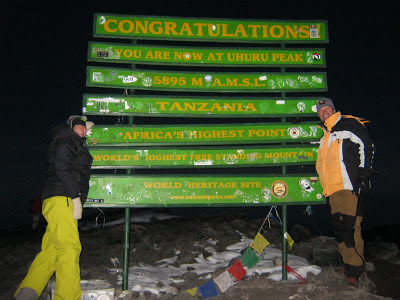 |
| At the Summit! |
Start: Barafu Camp 15,331 ft
Summit: Uhuru Peak 19,341 ft
End: Mweka Camp 10,200 ft
Elevation gain: 4,010 ft.
Distance: ~12 miles
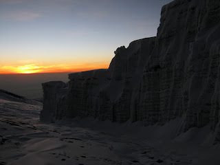 |
| Sunrise from summit |
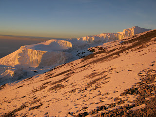 |
| Summit glaciers |
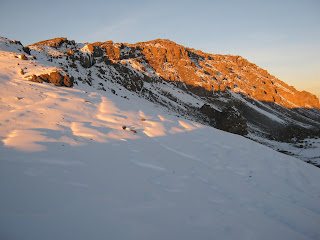 |
| View of Uhuru Peak summit |
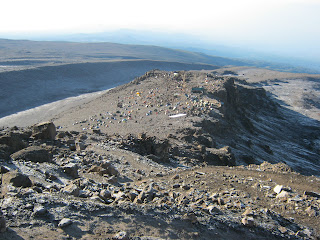 |
| Looking down of Barafu Camp |
SUMMIT DAY!! Just before 1:30am, I woke, dressed, readied my pack and set off up the mountain with my guide Simon. As I looked up the ridge toward the summit, I could see a long line of headlamps snaking through the darkness. It actually wasn't that dark for the moonlight was quite bright. In fact, I was able to climb the entire way without having to turn my headlamp on. It was quite cold when I started out but I made sure not to over layer as I new that I'd be warm in about ten minutes. Simon and I made steady progress up the ridge. To be honest, he set a pretty blistering pace. He wanted to make
sure that we'd meet Babaluu and my mother, who had started two hours
earlier, at Stella Point at the same time they arrive there. I was
surprised by how much easier the climb was than I had expected, even
with the brisk pace. We caught Babaluu and my mother about 400 feet
below Stella Point. They were slower but still making steady progress
and we reached Stella Point at 5am. By now. my fingers and toes were a
little cold be otherwise I felt fine. The toughest climbing was behind
us and an easy walk up the ridge to Uhuru Peak was all that remained. Thirty minutes later, we were
standing on the roof of Africa at 19, 341 feet. This was the highest
that I'd ever climbed. It was an amazing feeling to have reached the
top. We took pictures in front of the summit sign, drank some hot tea,
and then paced back and forth on the summit ridge to stay warm so that
we could see the sunrise. By about 6am, the sun was beginning to rise
and the summit was starting to get crowded. Before heading down to
Stella Point, I first walked down to the edge of one of the glaciers.
It was pretty cool. The hike back down to Barafu was very quick and
became increasingly warm as the sun rose higher above the horizon. I
made it back the the tents at 7:30am. I wanted to take advantage of the
beautiful weather and spread several days worth of wet clothes on the
rocks around camp so that they could finally dry. After my mom made it
back to camp, the cook prepared a nice brunch so that we could refuel
after our big climb. By around 10am, we packed up and started the long
descent to Mweka Camp. We did not descend the same route we had come
up, but instead went down the more direct Mweka Route. It was a long
hike down and the trail was very slippery after we passed High Camp.
Our total descent for the day was over 9000 vertical feet and many
miles. I was relieved when we finally made it into Mweka Camp as I
really wanted to get out of my hiking boots. Given that folks had
either achieved or given up on their goal by this point and were on
their way down, there was a decidedly laid back feel in camp. We were
too tired to really do much other than sit around and read. After
dinner, we went to sleep rather early, very tired and still basking in
the warm glow of our success.
Day 7:
 |
| Our amazing crew |
Start: Mweka Camp 10,200 ft
End: Mweka Gate 5,580 ft
Elevation loss: 5,900ft.
Distance: ~4 miles
 |
| Mweka Camp |
Our last day on the mountain. After packing up, we profusely thanked our crew for all that they had done for us and presented them their tips. They had all really earned it. The trail down to the Mweka Gate wound through dense jungle similar to the first day. It was an easy, pleasant walk down the mountain, taking just under 2 hours to get down. Today offered our best wildlife viewing as I saw at least a dozen blue monkeys swinging in the canopy above. After reaching the Mweka Gate, I signed us out of the park and sat on a bench to enjoy a well-deserved beer. After my mom made it down, we all piled
into the van that would take us back to Arusha. Babaluu presented us
with our certificates for having reached the summit on the drive back to
Arusha and the whole crew sang to us the songs of Kilimanjaro.
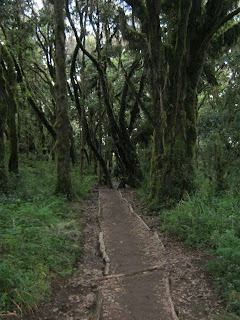 |
| Trail through jungle down to Mweka Gate |
KILIMANJARO SONG
Kilimanjaro, Kilimanjaro,
Kilimanjaro, mlima mrefu sana.
Na Mawenzi, na Mawenzi,
Na Mawenzi, mlima mrefu sana.
Ewe nyoka, ewe nyoka,
Ewe nyoka, mbona waninzungukaa.
It means:
Kilimanjaro, Kilimanjaro,
Kilimanjaro, long mountain journey.
And Mawenzi, and Mawenzi,
And Mawenzi, long mountain journey.
As a snake, as a snake,
As a snake, it winds all around.”
JAMBO BWANA SONG
Jambo, Jambo Bwana
Habari gani
Mzuri sana
Wageni, mwakaribishwa
Kilimanjaro yetu
Hakuna Matata
It means:
Hello, Hello Sir
How are you?
Very fine
Foreigners, you’re welcome
To Kilimanjaro
There is no problem


Hello James,
ReplyDeleteCan you please tell me what guide company did you use and would you recommend them based on your experience?
Thanks,
Rahul